1. Context
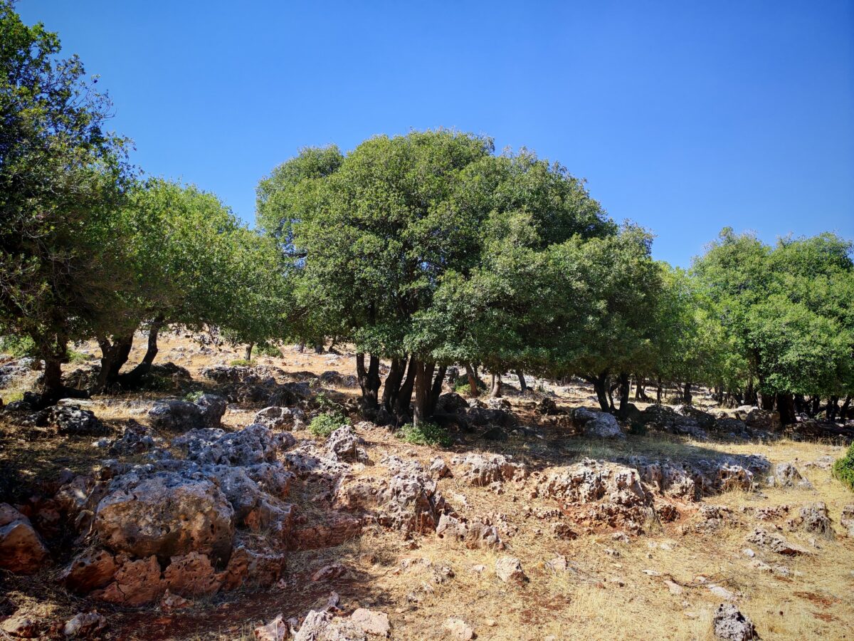
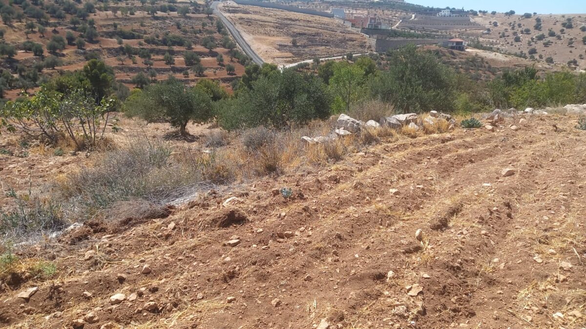
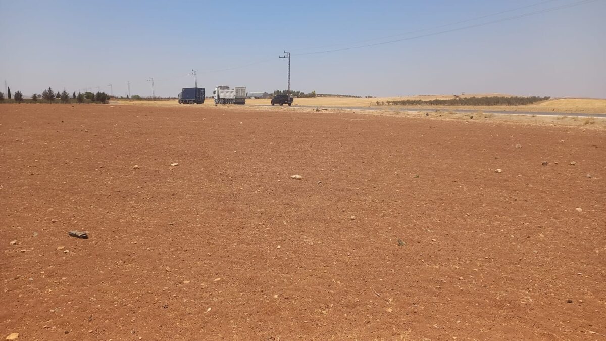
Broader biophysical and policy context: The Irbid–Jerash–Ajloun Soil Living Lab is proposed for the agricultural landscapes of Irbid, Jerash, and Ajloun governorates in northern Jordan. Irbid, in north-western Jordan, contains much of the country’s Vertisols and is considered one of Jordan’s leading agricultural regions, particularly for citrus, olives, cereals, and honey production. Jerash and Ajloun, located south of Irbid, include important rainfed agricultural systems and much of Jordan’s remaining forest areas. The region has high agricultural capability but is facing pressure from irrigated agriculture, greenhouse expansion, urban growth, and population increase. Therefrom, there is a policy-relevant need for sustainable intensification that maintains agricultural productivity while reducing degradation of soil, water, and biological resources.
Soil-related issues: The main concerns are linked to maintaining productive agricultural systems while minimizing land degradation. In rainfed, irrigated, and greenhouse farming systems, soil information is needed to guide soil fertility management, nutrient cycling, crop selection, irrigation, land evaluation, soil and water conservation, and soil-quality monitoring. Pollution risks, nutrient leaching, salinity, soil physical constraints, soil biodiversity, carbon sequestration, and climate adaptation are also relevant concerns. These issues are important for both farm-level decision-making and broader land-use planning, natural-resource management, and policy support
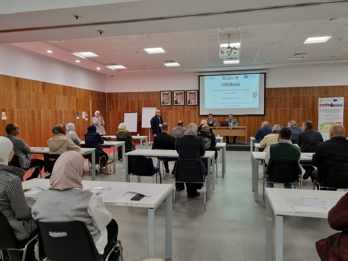
The Irbid–Jerash–Ajloun Soil Living Lab: The Irbid–Jerash–Ajloun Soil Living Lab is a proposed landscape-scale platform for sustainable soil and agricultural management in northern Jordan. It would be coordinated through the University of Jordan, with Prof. Jawad Bakri, Department of Land, Water and Environment, as SOILS4MED lead in Jordan. The Living Lab would bring together science, policy, and practice stakeholders to use Soil Data and Information and Soil Information Systems for sustainable intensification, land-degradation control, soil-quality monitoring, and climate-resilient agricultural decision-making.
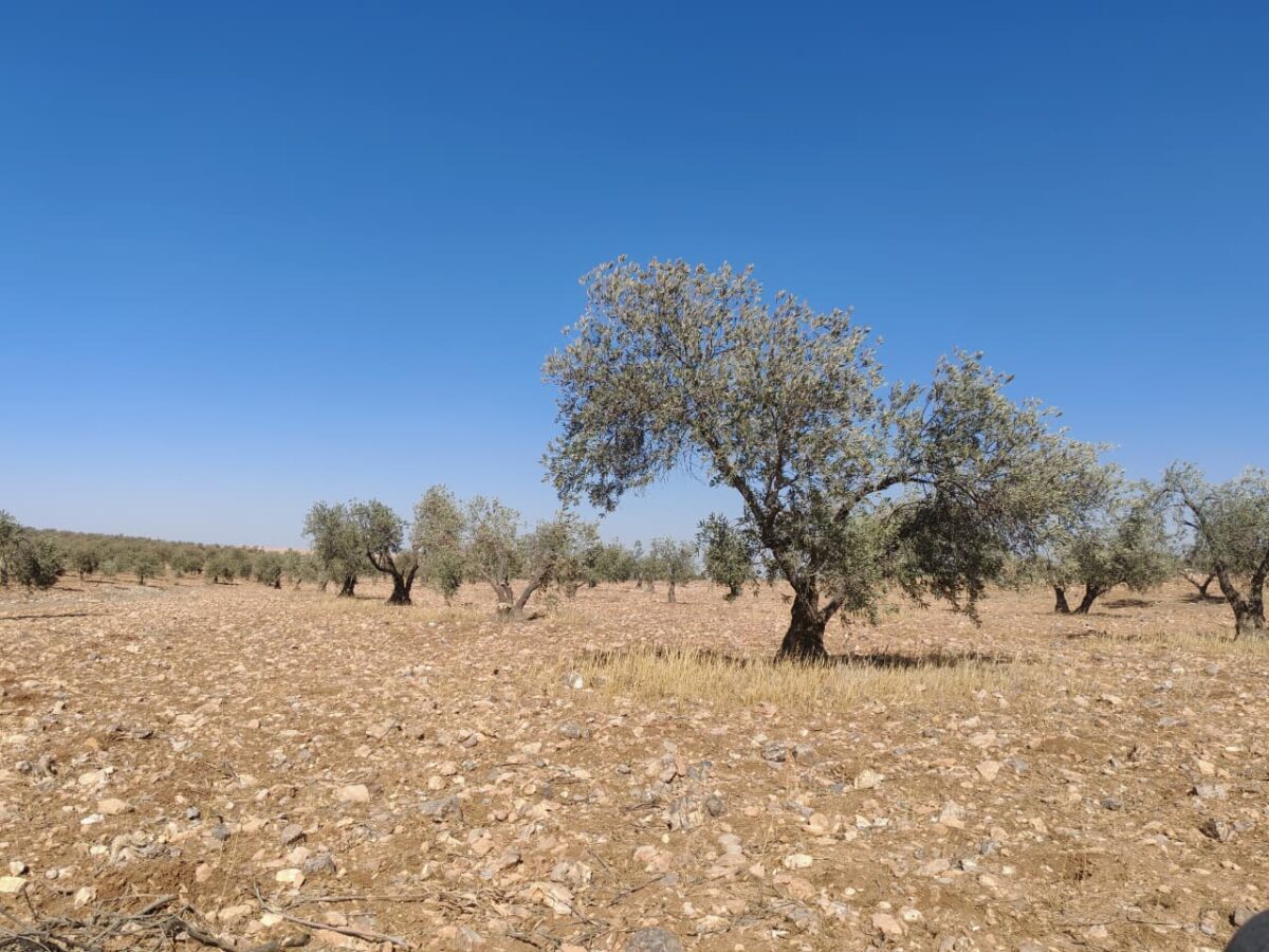
Landscape of the Irbid–Jerash–Ajloun Soil Living Lab.
2. Scale
The Soil Living Lab operates at two complementary spatial levels:
(i) Demonstration areas: Initial demonstration and intervention areas can be selected within representative farming systems across Irbid, Jerash, and Ajloun governorates. These may include rainfed orchards, cereal systems, irrigated farms, greenhouse systems, and areas experiencing land-use pressure. Demonstration sites can be used to test soil-quality monitoring, crop-suitability guidance, soil and water conservation, input-use recommendations, and extension-oriented decision-support tools.
(ii) Landscape scale: At the broader landscape level, the Living Lab focuses on the agricultural lands of Irbid, Jerash, and Ajloun governorates. This landscape-scale focus allows Soil Data and Information and Soil Information Systems to support sustainable intensification, land evaluation, land-use planning, carbon-stock assessment, land-degradation neutrality baselines and targets, and improved management across rainfed, irrigated, and greenhouse farming systems.
3. Aims
- Environmental & Social: Promote sustainable intensification that maintains agricultural productivity while reducing degradation of soil, water, and biological resources through support the innovative design of sustainable farming systems and promote efficiency-oriented innovation in rainfed, irrigated, and greenhouse farming systems
- Governance & Integration: improve the use of Soil Data and Information and Soil Information Systems for agricultural decision-making, extension services, land evaluation, land-use planning, policy analysis, and natural-resource management.
- Strategic Goal: To establish a soil-information-driven platform for guiding sustainable intensification in northern Jordan’s high-potential agricultural landscapes, ensuring that productivity gains in rainfed, irrigated, and greenhouse systems are achieved without degrading soil, water, biodiversity, or long-term land resources.
4. Activities
The following list details the initial core activities designed for the Living Lab, though additional tasks and methodologies may be added as the project evolves.
- Reviews, organize, and integration of soil information and data following a soil information system framework.
- Conduct participatory assessment of barriers, opportunities, and strengths of effective use of soil information and data for sustainable soil landscape management.
- Identification of policy-relevant soil health indicators that can support monitoring, planning, and agricultural decision-making.
- Field campaigns to measure relevant soil properties and description of representative soil profiles using regional SOILS4MED field protocol.
- Develop use cases of SDI and SIS: Use cases suggested by stakeholders are:
- Soil-quality monitoring and pollution protection: Soil data and SIS outputs can be used to measure soil quality in targeted areas and protect soil, water, and air from pollution. Relevant tools include soil sensitivity maps, standard specifications, global guidelines, and GIS applications. Relevant soil attributes include chemical and microbial indicators, such as heavy metals, pesticide residues, and microbial contamination, as well as physical indicators such as infiltration rate and permeability. Success can be assessed by the number of beneficiaries, number of variables used, number of targeted areas, periodic monitoring reports, and the formulation of national strategies.
- Crop suitability, SSWM guidance, and extension support: Soil information and databases can be used to recommend suitable crops and sustainable soil and water management practices, and to guide extension programs toward existing projects and crops. Relevant tools include crop-model and land-degradation DSS, national maps, GIS applications, dashboards, and a soil-data-based guide for production inputs. Relevant soil attributes include pH, salinity, CEC, nutrients, texture, structure, water-holding capacity, infiltration rate, bulk density, and soil-profile information. Success can be measured through the number of extension programs using the database, farmer adoption, reduced production costs, and increased production
- Piloting use cases through: (a) the development of a framework linking soil data to scientific tools/methods and the above use case, and (b) conducting the tasks and evaluate the outcomes with stakeholders.
- Build capacity through expert consultations, participatory workshops, computer lab and joint field sessions for training on soil information system, related scientific tools and selected soil-related tools.
5. Participants
The following organizations and groups constitute the initial stakeholder list; the partnership remains open to additional contributors from the local and international community.
- Science and research: University of Jordan, National Agricultural Research Center, Royal Scientific Society, Research communities working on soil, water, agriculture, land management, climate adaptation, and carbon sequestration
- Policy and agricultural administration: Ministry of Agriculture, Jordan Valley Authority, Public institutions involved in land-use planning, agriculture, water regulation, environmental management, and policy analysis
- Practice: Farmers and land managers in Irbid, Jerash, and Ajloun governorates, owners and managers of rainfed, irrigated, and greenhouse farming systems, agricultural extension actors and farmer advisory services
- Organizations involved in natural-resource management, habitat and biodiversity conservation, and soil and water conservation (e.g., Royal Society for the Conservation of Nature, IUCN).